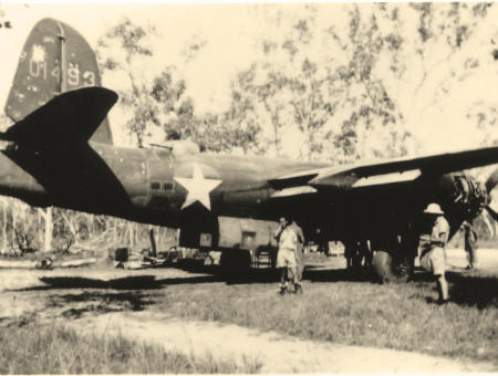
RAAF B26 at Woodstock. Photo: Dave Pratt
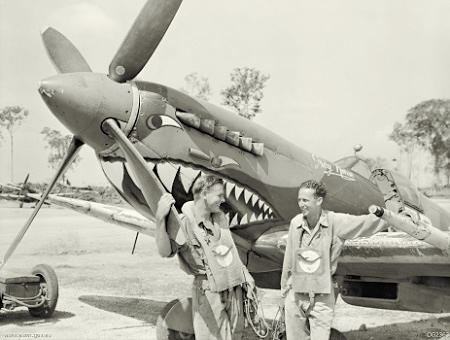
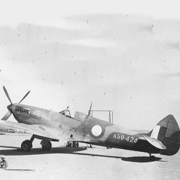
RAAF Spitfire. Photo: AWM
Queensland Airfields WW2 – 50 Years On …… The Book
By Roger R Marks
Published October 1994
THE QAWW2 BOOK… Covered the history of Queensland's most important WW2 airfields. The printed book was A4 size, 284 pages with full colour stiff card cover, 6 analytical Appendices, Bibliography and comprehensive Index. Inside, the approx 370 photos, map and drawing extracts are monochrome.
Now only sold as pdf document on usb stick…and includes the Google Earth kmz placemarks 'mapping' overlay recently announced. See below ›
Some people collect old clocks - for others it can be sporting figure cards, or the lowly postage stamp. Lately, an increasingly popular focus has settled on restoring old aeroplanes, often to factory-fresh flying condition. There, even minimal involvement evokes attention to the history of places where aircraft landed, taxied, were serviced, rested whole or in pieces, were loaded and dispatched to fly that cycle again. Such places were aerodromes and when the warrior in us prompts more interest in RAAF Kittyhawks or US B-26 Marauders, than the placid DeHavilland Gypsy Moth, we are ready to address this reference work on the WW2 Military Aviation History of Queensland
This book entitled Queensland Airfields WW2 - 50 Years On reviews more than 190 sites of relevance. It guides you right to them with current day map references and 'lat-longs' (GPS). For the 60 most prominent airfields in the State 1939-1945, a total of some 376 photos, maps and drawing extracts combine with the often verbatim reports and descriptions either dredged from Archives or taped from veterans.
The emphasis is constantly on authenticity. Wherever feasible the author has included the edge detail on surviving photos, whether he understands it or not! A fascinating list of WW2 period aerial photography of the sites makes up Appendix 4 in this book. Known sources and/or repositories of such surviving prints are set out. Regrettably, some such historic photography listed in old CPE (RAAF Central Photographic Establishment) Master Negative Registers does not appear to have survived. In crucial cases, the author has listed these too. He hopes that families poised to bin those old photos Dad had from the War, may pause and check the sketchy edge detail against Appendix 4.
Look on Queensland Airfields WW2 - 50 Years On as a coffee table standard… Take it with you on that caravan or bus trip you have planned through Queensland. Amongst the accounts of the 'big ones' like Garbutt, Charters Towers, Eagle Farm and Amberley, you'll find the frontier bases like Horn Island and Iron Range on Cape York or Inverleigh in the Gulf country. The book will take you right to the site but you should remember two things – many have reverted to just bushland and many to private property. Make sure you obtain permission before you enter.
The Airfields
The following is a list of the 60 prominent airfields given illustrated text—there are 130 odd OTHER lesser known which are also included in the analytical appendices.
|
|
The Appendices
- Locations
- Airfield Descriptions - From Airfield Data Sheets
- Drawings
- Aerial Photography - WW2 Period
- Units in Occupation
- Archive Sources
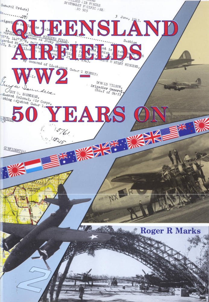
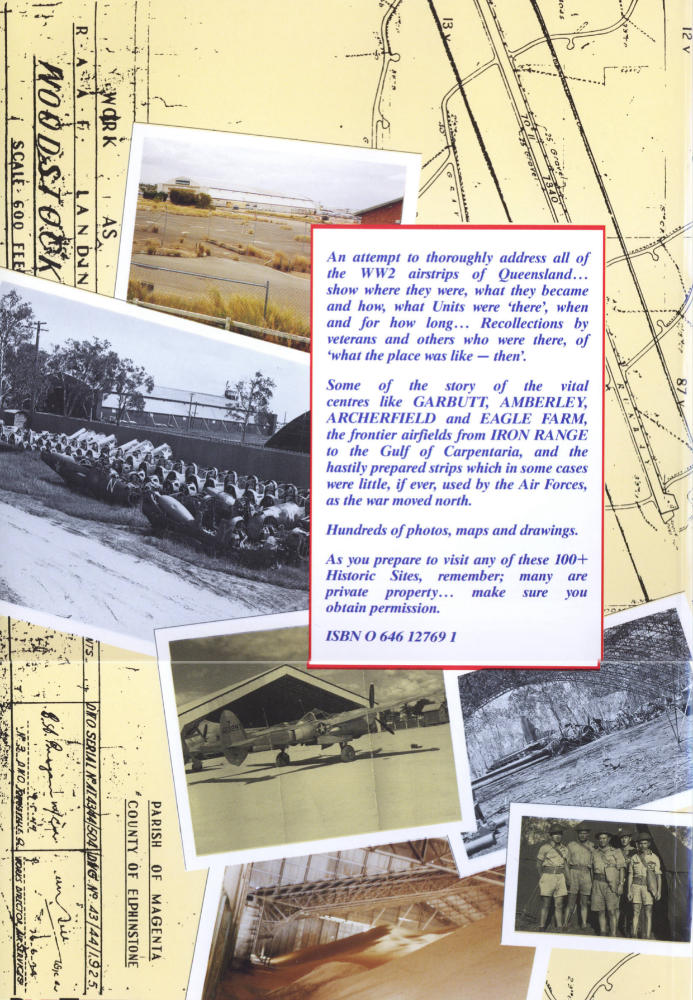
QAWW2 The Book: Front and Back Cover
Google Earth Map Overlay Now Available 
A QAWW2 placemarks .kmz file is now included on the usb with the book, whereby a user will be able to open the Google Earth application on their computer and have a spread of star markers appear, one at each of ALL 190 odd airfield sites showing WHERE the WW2 'site was'; if it's changed then the difference may be clear. A menu will install in the Google Earth My Places panel on the left of screen with a list of the QAWW2 placemarks, so any airfield can be rapidly 'homed in' as desired. Furthermore, a pdf companion file will be available for each site which will show much of the documentation, maps and drawings referred to in the appendices together with some info found SINCE Publication. This is THANKS to a purchaser, my ret'd airline pilot friend Peter H.
PS: Prior usb book purchasers seeking this add-on please contact me. RRM
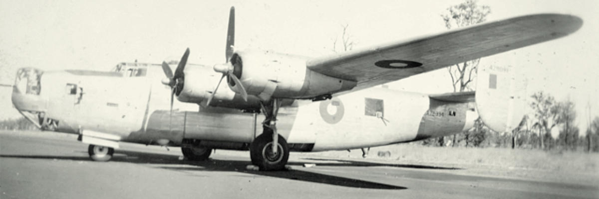
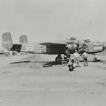
Cecil Plains, Qld, 1945. Port View of a Liberator B24 Bomber, A72-334, of No. 102 Squadron RAAF. Photo: AWM
Orders
While the book is no longer in print, it is now available in digital format word-searchable on USB Stick #1 posted anywhere in Australia. Interested?
Cost: $40. Free postage within Australia
To order this booklet, download and fill out our universal order form:
› Download Order Form (pdf)
› Download Order Form (doc)
Complete the form and return to the postal or email address provided on the form. The PDF version of the form can be filled out electronically or manually, printed and posted to us by mail, while the DOC version can be filled out using MS Word, saved to file and emailed to us.
Payment methods include cheque or electronic fund transfer. Items will be mailed upon receipt.
A major development since producing QAWW2 is my now enduring interest in a new project to… BRING HOME THE IMAGES…